Wetlands are among the most valuable ecosystems on Earth, providing flood protection, water purification, habitat for wildlife, and carbon storage. Because they are so ecologically significant and often protected under environmental laws, understanding where wetlands begin and end is critical for land development, permitting, and conservation. This is where wetland delineation comes in.
In this guide, we’ll answer what is wetland delineation, explain its meaning and process, review the indicators used to identify wetlands, and highlight its applications in environmental planning, land-use decisions, and restoration projects.
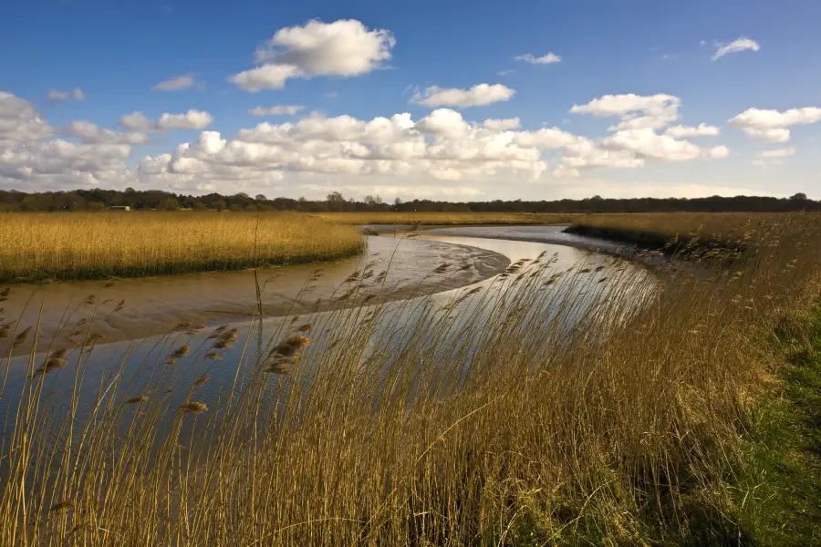
What Is Wetland Delineation?
At its core, wetland delineation is the process of identifying and mapping the precise boundaries of wetlands in a given area. The wetland delineation meaning extends beyond simply locating wet areas, it determines whether a site meets the official criteria to be classified and regulated as a wetland.
Why It Matters
- Regulatory compliance: In the U.S., delineations are often required for permits under Section 404 of the Clean Water Act, making 404 permit requirements central to many projects.
- Environmental protection: Accurate delineation helps preserve wetlands and their ecological functions.
- Project planning: Developers, engineers, and landowners rely on delineations to design projects that minimize environmental impacts and avoid costly violations.
In short, wetland delineation is the bridge between ecological science and environmental regulation.
The Wetland Delineation Process
Wetland delineation is systematic and follows guidance from agencies such as the U.S. Army Corps of Engineers, whose permitting process governs many water-related projects.
1. Pre-Field Activities
Before setting foot on a site, environmental professionals conduct background research:
- Reviewing aerial photographs, soil surveys, and topographic maps.
- Checking hydrologic data and historic wetland maps.
- Planning field visits to likely wetland areas.
2. Field Activities
During site visits, delineators collect evidence of wetland conditions. Key steps include:
- Identifying wetland indicators such as vegetation types, hydrology features, and soil characteristics.
- Mapping boundaries using GPS or survey equipment.
- Taking soil cores and photographs to document conditions.
3. Post-Field Activities
Once data is collected, specialists analyze findings and prepare reports that include:
- Detailed maps of wetland boundaries.
- Descriptions of soil, vegetation, and hydrology indicators.
- Documentation required for regulatory review and permitting.
Wetland Indicators and Criteria
To officially classify land as a wetland, three criteria are generally evaluated:
Hydrology Indicators
Hydrology is the most important factor—wetlands must have water present at or near the surface for a sufficient duration, a principle rooted in hydrology in civil engineering.
- Standing water, saturated soils, or watermarks on vegetation.
- Drift lines, sediment deposits, or drainage patterns.
Vegetation Indicators
Wetlands support unique plant communities dominated by hydrophytic (water-loving) species. Key indicators:
- Species such as cattails, sedges, or willows.
- Plant adaptations like buttressed tree trunks or shallow root systems.
Soil Indicators
Wetland soils, called hydric soils, show distinct physical and chemical properties. Signs include:
- Gleyed or mottled colors from prolonged saturation.
- Organic-rich layers or sulfur odors.
- Reduced conditions revealed in soil testing.
A site typically must meet all three criteria: hydrology, vegetation, and soils to be classified as a jurisdictional wetland.
Methods and Techniques for Wetland Delineation
Transect-Based Approach
Surveyors often walk transects (straight lines across the site) to record transitions between upland and wetland conditions. This method provides detailed, ground-based observations.
Aerial Imagery and Remote Sensing
High-resolution aerial photos and satellite imagery help identify vegetation patterns, water bodies, and seasonal changes that suggest wetlands.
Geospatial Tools and Technologies
GIS (Geographic Information Systems), GPS, and LiDAR enhance accuracy in mapping wetland boundaries, making GIS mapping a cornerstone of delineation.
By combining field methods with advanced technologies, professionals ensure that delineations are precise and defensible in regulatory contexts.

Applications of Wetland Delineation
Environmental Impact Assessments
Wetland delineations form a critical part of environmental impact assessments (EIAs), helping evaluate how projects may affect ecosystems.
Land-Use Planning and Conservation
Planners and developers use delineation maps to avoid sensitive areas, design buffer zones, and incorporate wetlands into sustainable site plans.
Wetland Restoration and Mitigation Projects
Wetland delineations form a critical part of the environmental impact assessment process, helping evaluate how projects may affect ecosystems.
In all cases, wetland delineation ensures that decisions are informed by science, legality, and ecological responsibility.
Conclusion
So, what is wetland delineation? It is the scientific and regulatory process of determining wetland boundaries through evidence of hydrology, vegetation, and soils. The meaning of wetland delineation lies not just in mapping ecosystems but in ensuring that development and conservation strike a balance.
From pre-field research to field surveys and geospatial mapping, the delineation process safeguards wetlands while giving engineers, planners, and regulators the information they need for responsible decision-making. Whether for environmental assessments, land-use planning, or restoration, wetland delineation is essential to protecting ecosystems that provide critical services to both people and nature.