
Cypress Environment & Infrastructure has our base of Florida operations in Pensacola, and this page is our Florida reference for the full wetland sequence: field delineation under the dual federal and state methodologies, the U.S. Army Corps of Engineers (USACE) jurisdictional determination (JD), the Environmental Resource Permit (ERP), and the federal and state authorizations that follow. It focuses on what differs here: Jacksonville District review across the state, Chapter 62-340, F.A.C., versus the Corps Coastal Plain supplement, ERP through the water management districts and FDEP, Section 401 certification carried in the ERP, UMAM mitigation scoring, and the unsettled status of Florida’s assumed Section 404 program.
Background topics have their own pages: how a wetland delineation works, approved and preliminary JDs, the Section 404 permit, and the broader list of environmental permits.
Where We Work in Florida
Our Florida office is at 13 Palafox Place in Pensacola. How far we travel depends on the size of the job. Mobilization is a large share of a small residential or house-lot delineation, so those projects are competitive in the northwest Florida footprint around the Pensacola office—Escambia, Santa Rosa, and Okaloosa Counties, and nearby counties in the same Panhandle market. On larger commercial, infrastructure, multi-parcel, or linear projects, mobilization becomes a smaller share of the fee, and we can reach farther across Florida, including sites reviewed by the Jacksonville District’s other sections and by the St. Johns River Water Management District (SJRWMD)—for example around Palatka—when the project scale absorbs the travel. We do not claim statewide coverage for small house-lot delineations.
Which Corps District Reviews a Florida Site
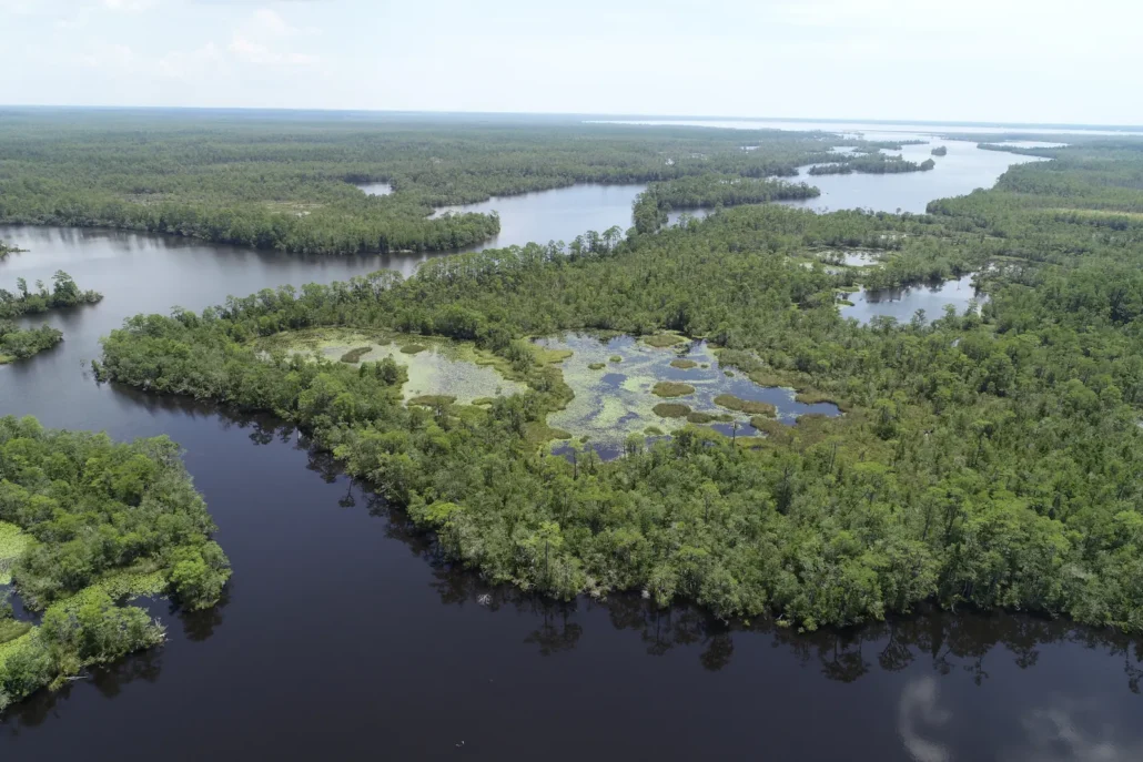
For Corps regulatory work, the Jacksonville District (SAJ) covers the State of Florida (plus Puerto Rico and the U.S. Virgin Islands). Unlike Alabama or Mississippi, Florida is not split between Corps districts for Section 404 and Section 10 permitting. The district’s North Branch includes a Pensacola Permits Section that reviews applications in Escambia, Santa Rosa, Okaloosa, Walton, Holmes, and Washington Counties; other sections (Panama City, Jacksonville, Cocoa, Tampa, Fort Myers, Palm Beach Gardens, Miami, and the Keys) cover the rest of the state. Confirm the section on the Jacksonville District office-locations page before filing. That includes the western Panhandle: the Mobile District does not handle Florida regulatory permits.
Wetland Delineation in Florida: Two Methodologies
Florida is unusual in that a single site often needs to satisfy two delineation standards. For Corps Section 404 and Section 10 review, the standard is the 1987 Corps of Engineers Wetland Delineation Manual as modified by the Atlantic and Gulf Coastal Plain Regional Supplement (Version 2.0, ERDC/EL TR-10-20, 2010). Most of Florida lies in the Outer Coastal Plain (LRR T) and Inner Coastal Plain (LRR P) subregions of that supplement. For state Environmental Resource Permitting, the exclusive statewide methodology is Chapter 62-340, F.A.C., adopted under section 373.421, Florida Statutes. The two share vegetation, soils, and hydrology as parameters, but they use different plant lists, tests, and data forms, and the state boundary can differ from the Corps boundary on the same property. We settle which products the client needs—Corps report, 62-340 report, or both—before fieldwork. Our Florida delineations are reviewed by Cynthia Henderson, PE, PWS, a Florida-certified wetland delineator.
Conditions that drive most boundary calls in northwest and north Florida:
- Wet pine flatwoods and savannas. Fire-maintained flats and flatwood depressions can dry out completely in late spring and summer, when FACU annuals can dominate, so soils and hydrology often carry more of the decision than the plant list under either methodology.
- Bedded pine plantations. Silvicultural bedding reshapes surface hydrology and soils. The Coastal Plain supplement’s Chapter 5 procedures for agricultural and silvicultural lands apply on the Corps side; the state methodology still requires reasonable scientific judgment under 62-340.
- Cypress domes, bayheads, and seepage slopes. Common on the Panhandle and northern peninsula. Boundaries can be abrupt at dome edges and gradual on seepage slopes; hydric-soil indicators and hydrologic evidence often fix the landward limit when vegetation grades.
- Tidal marsh, mangrove edges, and coastal strands. The Corps’ Section 10 limit in tidal waters is the mean high water line. State sovereignty submerged lands and coastal construction rules add separate lines. The report should address each line the reviewing agencies need.
- Altered hydrology. Ditches, berms, roads, and stormwater ponds change how water moves. Both methodologies require documenting alterations and explaining how they affect each boundary.
Our Delineation Process
- Desktop review. NWI maps, aerial imagery, FEMA flood zones, soil surveys, and topographic data, plus the Jacksonville District section, the water management district (NWFWMD, SJRWMD, or another), and whether the site needs a Corps product, a Chapter 62-340 product, or both.
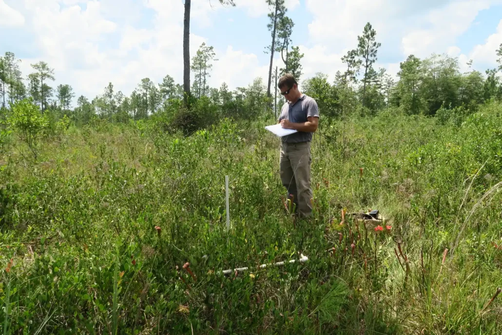
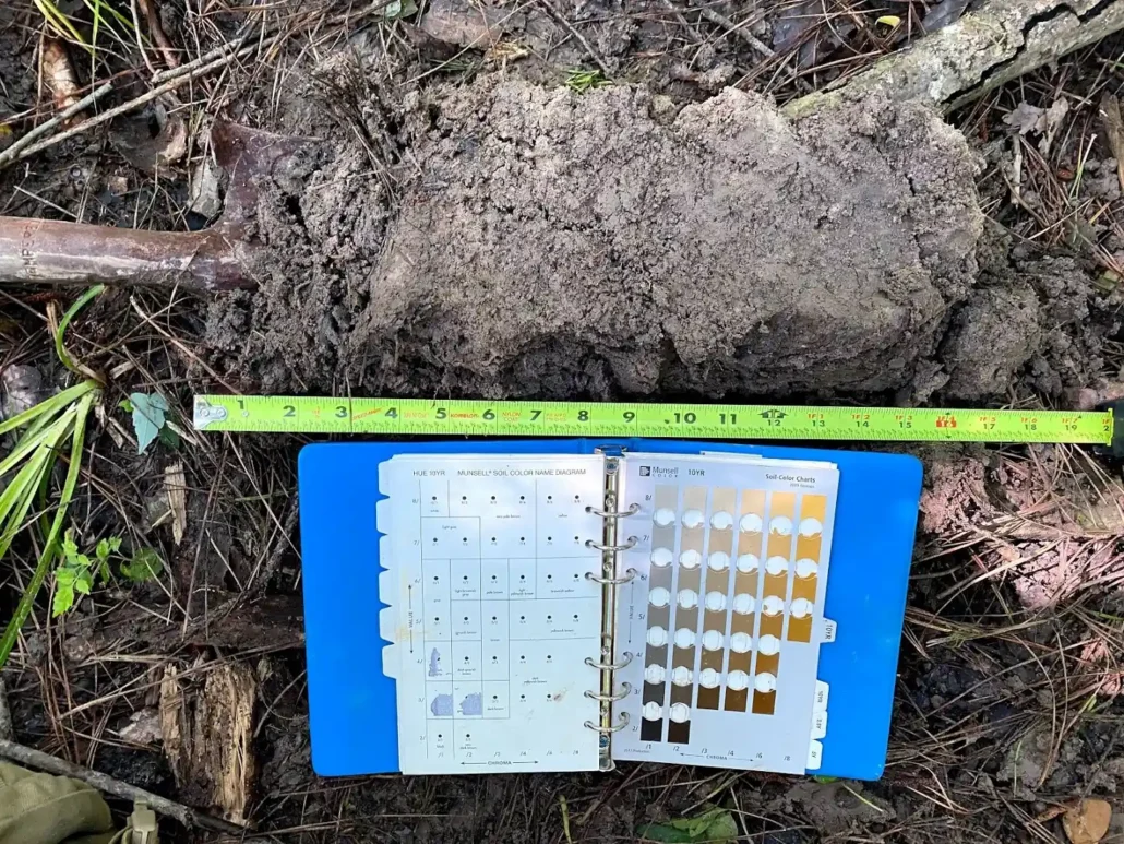
- Field investigation. Paired upland and wetland sample points at each boundary document plants, soil profiles, and hydrology indicators on the Corps Coastal Plain data form and, when needed, on the Chapter 62-340 data form.
- GPS mapping and flagging. We flag the wetland boundary in the field and map it with high-accuracy GPS, giving the design team and the agencies one spatial reference.
- Delineation report. Boundary maps, data forms, photographs, and field notes, formatted for the Jacksonville District section and for the ERP reviewing agency, with streams classified as ephemeral, intermittent, or perennial where relevant.
- Agency coordination. On request, we submit the report to the Corps for a JD, support a state formal determination petition under s. 373.421, or attach the delineation to the ERP and Corps applications.
Jurisdictional Determinations and State Formal Determinations
A delineation maps wetlands and other aquatic resources. A Corps JD is the district’s position on which of them are waters of the United States. An approved JD (AJD) gives a binding federal answer, normally good for five years (RGL 05-02), and can be appealed. A preliminary JD (PJD) assumes jurisdiction to move a permit forward; it is advisory, cannot be appealed (33 CFR 331.2), and cannot take a feature out of federal review. Turnaround is not published; PJDs generally come back much sooner. More on our JD page.
The federal rule in force. Florida is one of the 24 states where a federal court in North Dakota preliminarily enjoined the January 2023 rule on April 12, 2023. Jurisdiction here is decided under the pre-2015 regulations as narrowed by Sackett v. EPA (2023), not under the 2023 rule or its September 2023 amendments (EPA status page). A wetland qualifies only where it abuts a relatively permanent jurisdictional water with a continuous surface connection, which the agencies’ March 2025 guidance reads narrowly. EPA and the Army proposed a new definition on November 20, 2025 and supplemented it on September 9, 2026; it is not final. Our Sackett page has the background.
State formal determination. Separately from a Corps JD, a property owner (or other eligible petitioner) can petition FDEP or the water management district for a formal determination of the landward extent of wetlands and other surface waters under s. 373.421, F.S. A formal determination is binding for a period not to exceed five years so long as physical conditions on the property do not change so as to alter the boundaries (other than permitted changes). It answers the state ERP boundary question; it does not replace a Corps JD for federal jurisdiction. Informal or courtesy verifications are nonbinding.
In practice. Flatwood depressions and cypress domes separated from streams by upland, and ephemeral channels, are the features most likely to be found non-jurisdictional under Sackett. An AJD is often worth requesting where that finding would change the site plan. A non-jurisdictional federal finding does not end state review: ERP still regulates dredging, filling, and stormwater management in wetlands and other surface waters under Chapter 62-340, including many features the Corps no longer claims. Local floodplain and construction stormwater rules apply either way. See isolated wetlands.
Permits: Corps, ERP, and 401
Corps authorization
Small fills are usually authorized under a nationwide permit (NWP). The current NWPs were issued on January 8, 2026 (91 FR 768) and run from March 15, 2026 to March 15, 2031. The Jacksonville District posts its own regional conditions and Florida-specific notices; read those before relying on an NWP. Larger projects need an individual permit with public notice, and work in navigable waters also needs Section 10 authorization. An NWP authorization typically carries a condition that the applicant also obtain the appropriate ERP before construction.
Florida’s assumed Section 404 program (status)
Florida assumed administration of the Clean Water Act Section 404 program in certain waters under Chapter 62-331, F.A.C. A federal district court vacated EPA’s approval of that program in February 2024. The D.C. Circuit affirmed the vacatur on March 27, 2026, and on October 7, 2026 it denied both panel rehearing and rehearing en banc. Florida and the federal government may still ask the U.S. Supreme Court to review the decision. Until a court restores assumption, the Jacksonville District processes Section 404 applications statewide. Check the FDEP State 404 program page and the Corps for the status in effect when you file. This page does not decide whether a given water is assumed or retained.
Environmental Resource Permit (ERP)
ERP under Part IV of Chapter 373, F.S., and Chapter 62-330, F.A.C., is the state permit for dredging or filling in wetlands and other surface waters, for many structures in those waters, and for stormwater management systems that discharge to them. ERP operates independently of the federal dredge-and-fill program. In northwest Florida—including Escambia, Santa Rosa, and Okaloosa Counties—ERP is jointly implemented by the Northwest Florida Water Management District (NWFWMD) and FDEP. In the St. Johns River basin—including Putnam County and the Palatka area—SJRWMD (or FDEP under the operating agreement) is the reviewing agency. Other districts (Suwannee River, Southwest Florida, South Florida) cover the rest of the state. Confirm which agency has the parcel under the current operating agreement before filing. The delineation submitted with the ERP must follow Chapter 62-340.
Section 401 water quality certification
FDEP’s Section 401 water quality certification for Corps permits is integrated into ERP review. A grant or waiver of certification appears in the “Federal Review” section of the ERP authorization. The Corps cannot issue its permit until the state grants or waives certification. A complete ERP application (individual permit, notice of intent to use a general permit, or verification of exemption, as applicable) is the usual path to request certification. EPA proposed revisions to the federal certification rule (40 CFR Part 121) on January 15, 2026, so check the rule in effect when you file.
Other reviews
- Coastal construction and consistency. Projects seaward of the coastal construction control line or affecting the coastal zone may need additional FDEP coastal permits and federal consistency review. See our coastal consistency page and 401 and coastal permit overview.
- Listed species. The gopher tortoise is state-listed in Florida and often drives survey timing on Panhandle and peninsula uplands. A Corps permit brings ESA Section 7 consultation with the U.S. Fish and Wildlife Service into the schedule when federally listed species or critical habitat may be affected. Our gopher tortoise survey page covers survey scope.
- Local governments. Counties and municipalities apply their own floodplain, tree, and land-development rules regardless of federal or state wetland jurisdiction.
Compensatory Mitigation and UMAM
When wetland or surface-water impacts cannot be avoided or minimized, Florida agencies assess functional loss and required mitigation with the Uniform Mitigation Assessment Method (UMAM) under Chapter 62-345, F.A.C. (mandated by s. 373.414(18), F.S.). UMAM scores current condition, hydrologic connection, uniqueness, location, fish and wildlife use, time lag, and risk, and produces functional-gain and functional-loss figures used to size permittee-responsible mitigation or to debit and award mitigation-bank credits. The Jacksonville District also relies on UMAM for many Florida wetland mitigation decisions; confirm the district’s current practice at the pre-application meeting. Bank credit availability by service area is posted in RIBITS.
Related pages: mitigation banking, how stream mitigation works, and buying credits or establishing your own bank.
Cypress in Florida
We work Florida sites from our Pensacola office at 13 Palafox Place, with support from Biloxi and Mobile as needed. Small residential and house-lot delineations are focused on the northwest Florida footprint described above. Larger commercial, infrastructure, and multi-parcel work can reach farther—including SJRWMD / Jacksonville-section geographies such as the Palatka area—when project scale makes mobilization practical. On private sites we coordinate the delineation with mitigation planning, ERP and Corps permitting, and civil design. Cypress is licensed in Mississippi, Alabama, Louisiana, Florida, and Georgia.
Recent Florida work includes:
- Residential lot wetland delineation, Miramar Beach (private client). Field delineation and regulatory support to remove an erroneous county wetland designation so the lot could be developed.
- Commercial lot wetland delineation, Bonifay (private client). Wetland delineation for a commercial parcel ahead of site planning.
- Operational Range Assessment Program (ORAP), Eglin Air Force Base (U.S. Air Force). Range assessment support under a multi-firm term contract.
Frequently Asked Questions About Wetland Delineation in Florida
Is wetland delineation required before I apply for a permit in Florida?
If your project may place fill in wetlands or other surface waters, or build a stormwater system that discharges to them, the ERP reviewing agency needs mapped Chapter 62-340 boundaries. If a Corps permit is also required, the Jacksonville District needs mapped Corps-methodology boundaries. A delineation submitted with the application, a state formal determination, or a Corps JD provides that boundary.
How do I know if my property in Florida has wetlands?
Wetlands are not always obvious. Pine flatwoods, cypress domes, and seepage slopes can look dry for much of the year. Desktop maps such as NWI flag likely areas; the boundary itself comes from field data under Chapter 62-340 and, for federal review, the Corps Coastal Plain supplement.
Who regulates wetlands in Florida?
The Jacksonville District regulates waters of the United States under Sections 404 and 10. FDEP and the water management districts regulate wetlands and other surface waters under ERP (Chapter 62-330) using the Chapter 62-340 delineation methodology, and they grant or waive Section 401 certification as part of that review. Florida’s assumed Section 404 program remains vacated as of October 2026, so the Corps—not FDEP—issues federal dredge-and-fill permits. Listed species are handled with the U.S. Fish and Wildlife Service (and FWC for state-listed species such as gopher tortoise).
How long is a wetland delineation valid in Florida?
A Corps AJD normally stays valid for five years (RGL 05-02) unless new information comes up. A state formal determination under s. 373.421 is binding for a period not to exceed five years if site conditions have not changed so as to alter the boundaries. Delineation reports and PJDs carry no fixed federal expiration, but expect the agencies to ask for fresh data after site changes, a long gap, or a rule change. We refresh older reports for phased projects.
Does a non-jurisdictional Corps finding end the permitting?
It ends Corps review of that feature. ERP can still apply to the same wetland under Chapter 62-340, Section 401 still travels with the ERP when a federal permit is in play for other features, and local floodplain and construction stormwater requirements apply regardless of federal jurisdiction.
Do you delineate small house lots anywhere in Florida?
Small residential and house-lot delineations are offered in the northwest Florida footprint around our Pensacola office (Escambia, Santa Rosa, Okaloosa, and nearby). Farther from Pensacola, we evaluate larger commercial, infrastructure, and multi-parcel projects where mobilization is a smaller share of the fee. We do not advertise statewide house-lot coverage.
Reviewed by Cynthia Henderson, PE, PWS, a Florida-certified wetland delineator. Last reviewed: October 12, 2026.
Request Wetland Delineation in Florida
Send the parcel location, acreage, and what you plan to build. We will tell you which Jacksonville District section and which state programs apply, and whether you need a delineation, a Corps JD, a state formal determination, or an ERP package.
Call us at: 228-596-1580
Email: mfoster@cypressei.com
Florida office: 13 Palafox Place, Pensacola, FL. Headquarters: 772 Howard Avenue, Biloxi, MS. We also have an office at 150 Government Street, Suite 950-1000, Mobile, AL. Monday–Friday, 9 a.m.–5 p.m.