Every few years, a neighborhood that “wasn’t supposed to flood” ends up underwater. Homeowners are blindsided, developers face liability, and local governments scramble to explain why the risk wasn’t flagged earlier. Often, the answer is straightforward: nobody took the floodplain seriously.
Understanding what is a floodplain – not just as a regulatory category but as a living part of the landscape – changes how you approach construction, land use, and environmental planning. It’s the difference between building in a location and building with an understanding of what that location actually does.
What Is a Floodplain?
The short floodplain definition: a flat area of land next to a river or stream that gets covered with water during floods. But that description undersells what floodplains actually are.
Floodplains aren’t just places that occasionally flood. They’re a natural part of how river systems work – areas that have spent centuries absorbing excess water, filtering sediment, and keeping rivers from getting out of control during storms. When a river overflows its banks, the floodplain is where that water is supposed to go. It’s a pressure release valve built into the landscape.
They also tend to be rich in wildlife and plant life. The periodic flooding that makes them tricky for development makes them excellent habitat – fertile soils, steady moisture, and the kinds of plants and animals that depend on seasonal water. Wetlands, riverside forests, and productive farmland are all common features of healthy floodplains.
So when someone asks for a floodplain definition, the complete answer involves both the risk and the function. It’s an area that floods – and an area that’s supposed to flood, because that flooding serves a purpose.
How Is a Floodplain Formed?
Floodplain formation is a slow process, measured in centuries rather than years. Understanding how a floodplain is formed helps explain why these areas behave the way they do – and why changing them has consequences that aren’t always immediately obvious.
The process moves through several stages:
- Erosion. During heavy rain events, fast-moving rivers wear away their banks and gradually widen the valley floor.
- Transport. Water carries sand, silt, and clay downstream – material that was washed off riverbanks and the surrounding land.
- Sedimentation. As the river slows down and spreads across flat land, that material settles to the bottom. Layer by layer, this builds up the flat ground of a floodplain.
- Meandering. Rivers rarely run straight. As they curve and shift over time, they deposit material on the inside of bends and wear away the outside – slowly reshaping the surrounding land.
- Flooding. Each flood adds another layer of sediment and widens the flat area a little. Answering how a floodplain is formed ultimately comes back to this: it’s a cycle of water, sediment, and time – repeated over thousands of years.
The result is some of the most fertile and ecologically valuable land on earth. It’s also some of the most complicated land to build on responsibly.
Natural Processes vs Human Impact
Left alone, a floodplain manages water remarkably well. Rivers shift, sediment builds up, wetlands soak up heavy rain, and the whole system reaches a kind of natural balance. Human development upsets that balance in ways that are well-documented – and often underestimated.
Flood walls and earth barriers hold rivers inside their channels, which works fine in normal conditions, but makes flooding much worse if those structures are overtopped or break. Dams upstream alter how much sediment and water reach the floodplain, disrupting the natural patterns that have shaped it over centuries. Development – parking lots, roads, rooftops – replaces ground that absorbs rain with hard surfaces that send it rushing straight into rivers, increasing the speed and volume of runoff.
The result is that developed floodplains often behave very differently from natural ones. The water still has to go somewhere. When the ground can no longer absorb it, and the natural overflow areas have been blocked, it flows into buildings instead.
Floodplain engineering emerged as a field precisely because these forces need to be studied, modeled, and planned for. The Army Corps of Engineers handles much of the federal flood infrastructure work in the U.S. At the project level, floodplain engineering involves water flow analysis, risk assessment, and designing structures that work with flood behavior rather than pretending it doesn’t exist.
Can You Develop or Build in a Floodplain?
Yes – but only with a clear picture of what’s involved and the right permits in place before construction starts.
The FEMA Flood Map Service Center is the starting point for any project in a flood-prone area. Flood maps show risk levels and determine what rules apply to a given piece of land.
Beyond the maps, responsible development in flood-prone areas typically involves:
- Zoning compliance. Many areas limit where homes can be built near rivers and require minimum distances from the water’s edge.
- Elevation requirements. In high-risk flood zones, buildings are usually required to be raised above a FEMA-set water level.
- Flood-resistant construction. Any part of a building that could get wet needs materials and design details that can handle it.
- Drainage systems. The site needs to manage stormwater without pushing flood risk onto neighboring properties.
- Environmental review. Work near rivers and wetlands often requires permits under the Clean Water Act, including Section 404 approval.
- Flood insurance. Homes in designated flood zones with federally backed mortgages are required to carry coverage through the National Flood Insurance Program.
Getting all of this right takes experience. The rules are layered, and the cost of missing something – delayed permits, required teardowns, liability for flood damage to neighbors – can be far greater than the cost of doing it properly from the start.
Cypress Can Help
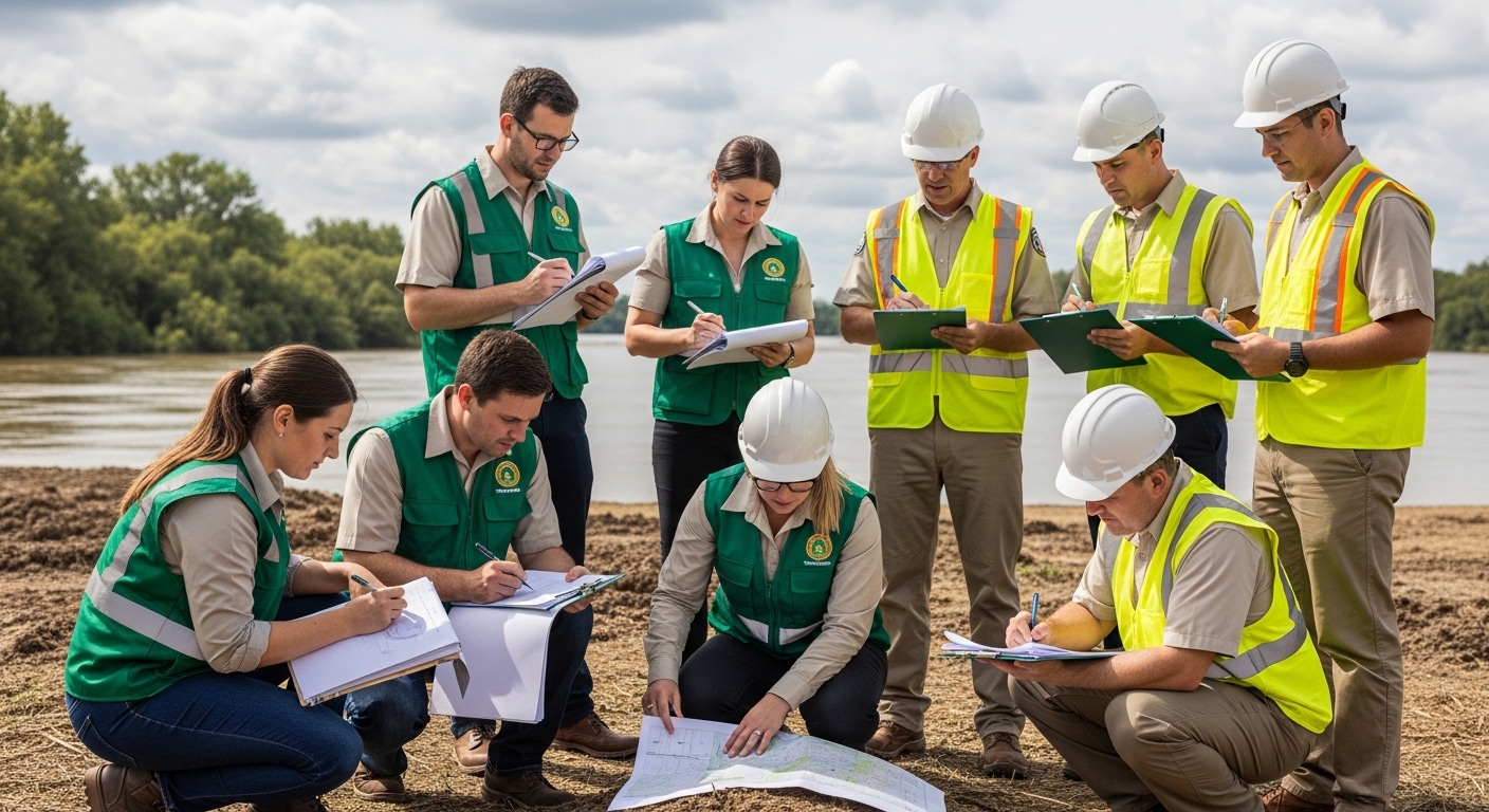
Cypress Environment & Infrastructure works with developers, local governments, and construction teams across the Gulf Coast on exactly these situations. The region – Florida, Alabama, Mississippi, and Louisiana – has some of the most complex flood environments in the country, where coastal storms, river flooding, and wetland regulations often overlap on the same project site.
The Cypress team handles the pre-construction work that determines whether a project in a flood-prone area is viable: water flow modeling and flood analysis, wetland surveys, environmental assessments, and the technical paperwork required to obtain regulatory approvals. Sorting this out at the start of a project is a lot cheaper than finding problems after the concrete is poured.
If you’re looking at a site near a river or in a low-lying area, talk to the Cypress team before breaking ground.
Floodplain Restoration and Environmental Protection
In many developed areas, floodplains have been cut off from the rivers they belong to – blocked by flood walls, drained for farming, or paved over. Floodplain restoration reconnects them, with real benefits for both flood control and wildlife.
The case for floodplain restoration keeps getting stronger. Restored floodplains absorb floodwater in ways that concrete infrastructure simply can’t match at the same cost. They filter farm and city runoff before it reaches rivers. They support fish and wildlife, especially species that need floodplain habitat to breed and feed. And they do all of this at a fraction of the long-term upkeep cost of engineered flood control structures.
Common restoration approaches include:
- Removing or pulling back flood walls to let the floodplain reconnect with the river
- Taking down old dams and barriers that block the natural flow of water and sediment
- Replanting wetland and riverside vegetation that holds banks in place and soaks up floodwater
- Restoring natural curves to streams that have been straightened out
- Letting soil and plants do the work of filtering water naturally
The EPA’s wetlands program and NOAA’s habitat conservation work both fund and support federal floodplain restoration, and many states run their own programs.
Real-World Floodplain Example Cases
Real examples make the principles much easier to grasp. Here are a few floodplain example cases where restoration and smart management have made a measurable difference:
- Mississippi River. Decades of building flood walls along the Mississippi squeezed the river, reducing its natural overflow capacity. In several areas, those walls have since been moved further back from the channel – giving the river more room and reducing flood levels for cities downstream. It’s probably the most closely studied floodplain example in the country.
- Rhine River, Germany, and the Netherlands. A program called “Room for the River” widened the river corridor by relocating roads and buildings, excavating floodplains, and creating temporary flood storage areas. The outcome was a real drop in flood risk for cities further downstream – not through bigger walls, but by giving the river more space.
- Gulf Coast wetlands, Louisiana. Large-scale restoration projects along Louisiana’s coast are rebuilding land lost to sinking ground and rising sea levels. These restored areas act as natural flood buffers for coastal towns while also bringing back important wildlife habitat – two benefits from the same investment.
What Is the True Cost of Building in a Floodplain?
The initial numbers on floodplain development can look good. Land is often cheaper, sites are available, and the risk seems manageable. The full picture looks different once you add everything up.
- Flood damage. Even a moderate flood can cause serious structural damage, ruin contents, and require mold cleanup that costs more than whatever was saved on land.
- Insurance. Flood insurance rates in high-risk areas have risen significantly, especially since FEMA updated its risk calculations for individual properties.
- Ongoing repairs. Roads, utilities, and building foundations in flood-prone areas wear out faster and need to be replaced sooner than comparable work in lower-risk areas.
- Permit and compliance costs. Elevation requirements, Clean Water Act permits, and local flood rules all add to the project budget – and are easy to underestimate without someone who knows the process.
- Property value. Homes in flood zones sell for less, and that gap is growing as buyers and lenders pay closer attention to flood risk. Properties that seemed like reasonable bets a decade ago are being reassessed.
- Environmental liability. Building in or near wetlands without the right permits can result in mandatory restoration orders and fines that make the original project cost look small.
The case for getting this right from the beginning – truly understanding what a floodplain is, what it means for a specific site, and what the rules require – comes down to simple math. Finding out the hard way costs more.