A few years ago, getting detailed aerial data over a large area meant hiring a plane or sending a crew out for days. Both were expensive. Neither was fast. Today, one operator with a drone can cover hundreds of acres in an afternoon and return with data that rivals what those methods produce.
What is drone mapping? It uses unmanned aerial vehicles to systematically photograph an area, then processes those photos into accurate maps and 3D models. The drone flies a grid, photographs everything below it, and software stitches the images together into something you can measure. A site manager in an office can review a map taken that morning and make decisions that used to require boots on the ground.
What Is Drone Mapping? Key Concepts and Technology
To understand what drone mapping is at a technical level, you need to know what the drone is actually collecting. It’s not just photography. It’s spatial data.
Every image taken during a mapping flight is tagged with GPS coordinates – the exact position in three-dimensional space where the drone was when the shutter fired. This geotagging is what turns a folder of images into something useful. Without coordinates, you have a photo gallery. With them, you have a mathematically precise record of the ground.
The process that converts those photos into a map is called photogrammetry. The drone flies back and forth over the site in a grid pattern, taking hundreds of overlapping images. Processing software finds matching features across different photos, calculates the geometry between them, and builds a 3D reconstruction of the surface from the ground up.
What is drone mapping used for in practice? The outputs can be used to measure:
- Distance – road lengths, fence lines, property boundaries.
- Area – parcel size, roof coverage, and disturbed zones on a construction site.
- Volume – how much material is in a stockpile, or how much has been removed from an excavation.
- Elevation – slopes, grades, and surface contours.
- Contour mapping – topographic lines are used to understand drainage and runoff.
A ground crew using traditional survey equipment can take two or three days to collect enough points across a complex site. A drone does the same area in under an hour. On a long project, that difference adds up.
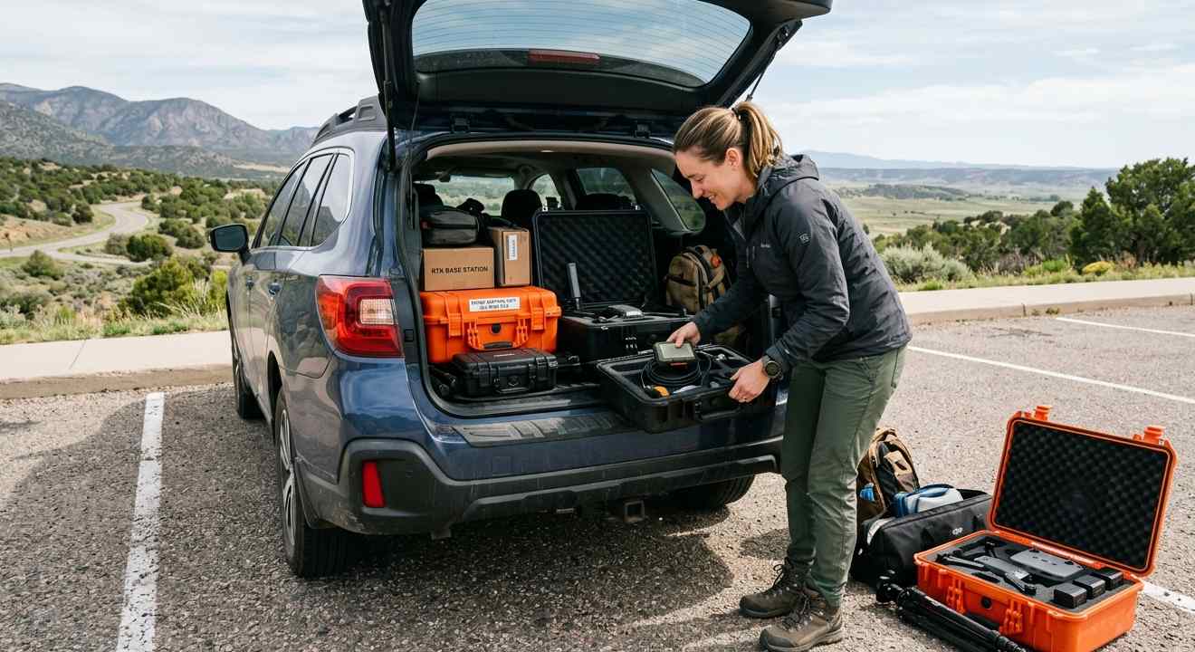
Essential Tools for Drone Mapping
Not every drone works for mapping. You need stable hardware, the right sensors, accurate positioning, and software that can handle large image sets.
- The aircraft. Multirotors are easier to deploy and more maneuverable in tight areas. Fixed-wing platforms fly longer and cover more ground per battery, which matters on large sites. The type of project usually makes the choice obvious.
- Positioning. Accuracy in drone surveying and mapping starts with GPS quality. Consumer drones are accurate to a few meters – fine for photos, not for survey work. Professional setups use RTK or PPK workflows, which compare drone GPS data against a known ground reference and correct errors in real time or post-processing. The result is centimeter-level accuracy. Without this, a map can look right but be shifted several meters from its true location.
- Flight planning software. Nobody flies a mapping mission with a joystick. You draw a boundary on screen, set the altitude and target resolution, and the software figures out the flight path – including exactly where to trigger the camera to ensure sufficient overlap. The drone flies the mission autonomously. This removes the human error that would otherwise affect every single photo.
- Processing software. After landing, the images are sent to a processing platform. Pix4D, DroneDeploy, and Agisoft Metashape are the common ones. They stitch the photos together and generate orthomosaics, 3D point clouds, digital elevation models, and GIS exports. Cloud-based processing means you can upload from the field and have finished products before you’re back at the office.
- Sensors. A standard RGB camera handles most mapping work – construction, general surveying, and inspection. Some applications need more: Multispectral sensors measure light beyond what the human eye sees. Farmers use them to detect crop stress before it becomes visible. LiDAR fires laser pulses and measures return time to build a point cloud. It maps through the tree canopy to the ground underneath – cameras can’t do that. Thermal sensors detect heat. Used for finding building leaks, mapping buried infrastructure, or locating people during search operations.
Applications of Drone Mapping Across Industries
UAV mapping has found a place in almost every field that deals with land or physical infrastructure.
- Construction
Drone mapping for construction has become routine on large projects. Project managers fly the site weekly – sometimes daily on fast-moving jobs – and compare current conditions against design plans. A floor slab that’s a few inches off center gets caught before concrete is poured on top of it. Cut-and-fill calculations that once required full survey crews can now be completed from a single drone flight.
The financial logic is straightforward: catching a problem early costs almost nothing. Catching it after three more phases of construction have been built on top of it can cost a project.
- Agriculture
Multispectral sensors let farmers see crop stress weeks before it becomes visible. A drone can identify zones that need more water or fertilizer, and the farmer treats only those zones rather than the entire field. This reduces chemical use, lowers costs, and, in some cases, improves yields. Some operations use the data to forecast harvest months out.
- Mining and Quarrying
Measuring stockpile volumes used to mean sending workers onto unstable piles of material. UAV mapping changed that. The drone flies over, captures the geometry, and the software calculates the volume. Faster, safer, and more repeatable than any ground method. Most mining operations now run stockpile surveys on a fixed schedule as part of routine inventory management.
- Disaster Response
When a flood or fire blocks ground access, drones go in first. They generate maps of affected areas within hours of deployment. Search and rescue teams use the imagery to figure out which roads are passable and which structures are unsafe to enter. After wildfires, mapping burn severity helps plan reforestation and erosion control.
- Infrastructure Inspection
Bridges, dams, power lines, communication towers – inspecting these traditionally meant working at height or in hazardous conditions. A drone gets close to hard-to-reach components and captures detailed imagery. The inspector reviews it from the ground. Nobody climbs.
Advantages of Using UAV Mapping
The case for UAV mapping usually comes down to speed, detail, and cost.
- Speed. A week of ground survey becomes a morning flight. Frequent data collection – mapping a site every few days – becomes practical and affordable. Teams that need current data to make decisions stop waiting for it.
- Detail. A traditional survey produces hundreds of measured points. A drone produces millions. The resulting model is continuous – every part of the surface is represented, not just the spots where a crew happened to stand. 3D models built from drone data are smooth and accurate enough for engineering-grade analysis.
- Safety. Surveyors who used to work on steep slopes, near moving equipment, or in contaminated areas can stay on the ground while the drone collects data. Fewer people exposed to hazardous conditions means fewer incidents.
- Cost. The upfront equipment investment is real. The per-project cost is significantly lower than that of traditional methods. When you factor in faster turnaround, earlier problem detection, and reduced rework, the numbers usually favor drones quickly.
- Sharing and archiving. Digital outputs are easy to distribute. A contractor, owner, and design engineer in different cities can all work from the same dataset. Data from two years ago is still accessible and comparable to what was collected last week.
Challenges and Considerations in Drone Mapping
Drone mapping is not simple. There are genuine constraints that affect every operation.
- Regulations. Airspace is regulated. In the US, commercial operations require a Part 107 Remote Pilot Certificate. Flying near airports, over people, or in controlled airspace needs authorization that can take time to obtain. Rules vary by country and change periodically. Getting this wrong isn’t a minor administrative issue – it can ground a project or result in fines.
- Weather. Wind degrades image sharpness and drains batteries – rain grounds most platforms. Harsh midday lighting causes glare and shadows that make photogrammetric processing difficult. Mission planning almost always involves watching the forecast and sometimes rescheduling.
- Data volume. One flight produces gigabytes of imagery. Processing it requires capable hardware or a fast cloud connection. Storing, managing, and sharing large datasets takes infrastructure. Getting drone outputs to work cleanly within existing GIS or CAD workflows requires some setup – it doesn’t happen automatically.
- Skill. Drone aerial mapping is not point-and-shoot. It requires an understanding of photogrammetry, GPS accuracy systems, flight planning, and processing software, in addition to regulatory compliance. The gap between data that looks fine and data that’s actually accurate enough to use for engineering decisions is real. Bad field technique shows up as problems in the final product.
Tips for Getting Started with Drone Aerial Mapping
If you are looking to enter the world of drone aerial mapping, start with a clear plan. The learning curve can be steep. But the rewards are worth the effort:
- Define what you actually need before buying anything. Volume calculations need a different setup than crop health assessment. Matching the sensor to the use case prevents expensive hardware mistakes.
- Sort out the legal requirements first. Certification, airspace authorization, and liability insurance need to be in place before any commercial work. These take time.
- Start on something small. A low-stakes project with a simple site is the right place to learn what settings produce what results. Flying complex sites before you understand the basics of overlap and altitude is a reliable way to collect unusable data.
- Don’t scrimp on overlap. A 70-80% image overlap between adjacent photos gives processing software enough common points to build accurate models. Less than that and you’ll see gaps or distortion in the final output. When in doubt, set overlap to a higher value.
- Use ground control points. Physical markers placed on the ground and measured with survey-grade GPS tie the drone data to known positions. This matters when outputs need to align with existing survey data or withstand professional scrutiny.
Done right, drone aerial mapping produces results that are hard to get any other way at anywhere near the cost.
The field keeps moving. Sensors get smaller and cheaper. Processing gets faster. AI is beginning to handle interpretation tasks – detecting cracks, flagging anomalies, classifying surface types – that previously required manual review. Drone mapping that currently takes hours will take minutes. The industries already using it will use it more, and the ones still on the fence will run out of reasons to wait.
Cypress Engineering provides surveying, mapping, and data analysis services, including UAV mapping for infrastructure, construction, and land development. Get in touch to discuss your project.