Advances in technology have transformed the way engineers, surveyors, and environmental professionals gather data. One Advances in technology have transformed the way engineers, surveyors, and environmental professionals gather data. One of the most powerful tools to emerge in recent years is drone mapping, also called UAV mapping. By combining aerial drones with high-resolution cameras and sensors, professionals can quickly generate accurate maps and 3D models of land, infrastructure, and natural environments.
For civil and environmental engineering firms, understanding what is drone mapping, how it works, and what it is used for is critical. From site assessments to wetland delineations and construction planning, drones are now reshaping the way we view and measure the world around us.
What Is Drone Mapping?
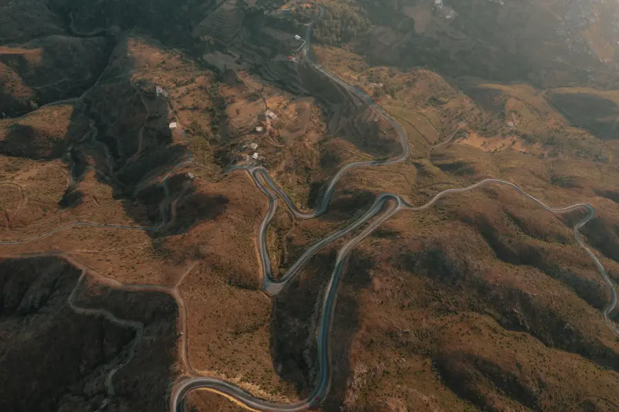
Drone mapping is the process of using unmanned aerial vehicles (UAVs), commonly known as drones, to capture aerial imagery and sensor data of a site. This data is then processed into detailed maps, 3D models, and geospatial information products.
Compared to traditional surveying methods, drone mapping offers faster coverage of large areas while maintaining centimeter-level accuracy. It is essentially UAV mapping—using drones to collect geospatial data for engineering, environmental management, and planning.
Key Components of Drone Mapping
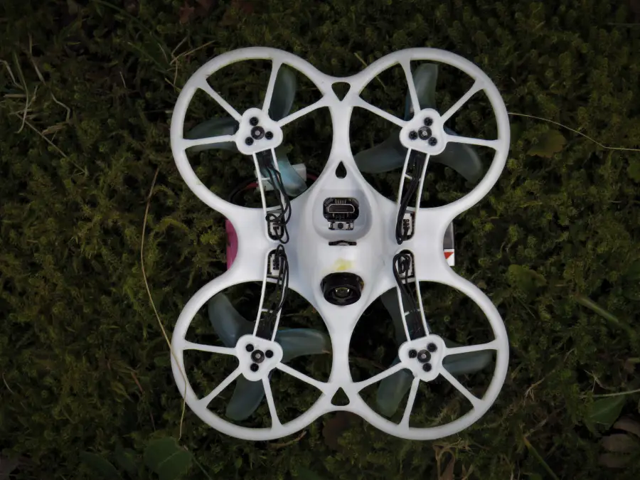
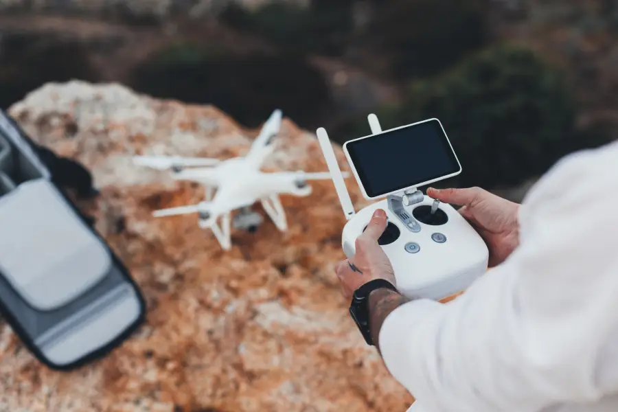
- UAV Platform: The drone itself, which can range from small quadcopters to larger fixed-wing models.
- Sensors and Cameras: Tools mounted on the drone to collect visual, thermal, or LiDAR data.
- Flight Software: Automated route planning and control systems that ensure consistent data capture.
- Data Processing Tools: Software that stitches images and sensor readings into usable outputs like orthomosaic maps, 3D terrain models, and digital elevation models (DEMs).
Role of Drones in Mapping and Surveying
Drones have significantly expanded the scope of modern surveying and mapping. Traditionally, ground-based survey teams collected data with total stations, GPS receivers, and manual fieldwork. While still valuable, these methods can be slow, labor-intensive, and limited in coverage.
Drone mapping changes that dynamic:
- Large areas covered quickly: Drones can map hundreds of acres in a fraction of the time.
- High-resolution imagery: Images can achieve centimeter-level accuracy depending on the equipment and processing.
- Accesibillity: Drones can fly over challenging or hazardous terrain, such as wetlands, steep slopes, or construction zones.
- Integration with GIS: Integrating seamlessly with GIS mapping systems for advanced analysis.
In environmental engineering, drones have become invaluable for habitat monitoring, site remediation assessments, and stormwater management planning.
Drone Technology and Sensors
Types of Drones Used in Mapping
- Multirotor Drones: Compact and highly maneuverable, ideal for smaller sites or areas requiring precision.
- Fixed-Wing Drones: Cover larger areas efficiently and are better for longer flight times, often used in agriculture, forestry, and infrastructure surveys.
- Hybrid Drones: Combine vertical takeoff capability with fixed-wing endurance, bridging the gap between flexibility and efficiency.
Types of Sensors Used in Drone Mapping
The choice of sensor determines the kind of data captured and how it can be applied:
- RGB Cameras: Standard cameras for high-resolution imagery and orthophotos.
- Multispectral Sensors: Capture data beyond visible light, useful in agriculture, forestry, and environmental monitoring.
- Thermal Cameras: Detect heat signatures, often used for energy audits, wildlife monitoring, or search and rescue.
- LiDAR Sensors: produce highly accurate elevation models, crucial for topographic surveys.
Drone Mapping Workflow
So, how does drone mapping work? While equipment varies, the workflow generally follows a consistent process:
- Planning the Flight
- Define the survey area and mapping objectives.
- Use flight planning software to create waypoints and flight paths.
- Consider regulatory requirements, such as FAA Part 107 in the U.S.
- Data Collection
- The drone flies the planned route, capturing overlapping images or sensor data.
- Ground control points (GCPs) may be placed for higher geospatial accuracy.
- Data Processing
- Raw images and sensor readings are uploaded into processing software.
- Photogrammetry software stitches images together into orthomosaics, DEMs, or 3D models.
- LiDAR or multispectral data is processed into specialized outputs for terrain or vegetation analysis.
- Analysis and Output
- Engineers and planners interpret the data.
- Outputs may include topographic maps, volume measurements, site progress reports, or environmental condition assessments.
Benefits of Drone Mapping
Advantages
- Speed and Efficiency: Large areas mapped in hours instead of days.
- Cost Savings: Reduced labor and equipment needs compared to traditional surveys.
- Safety: Minimizes risk by surveying hazardous or difficult-to-reach areas remotely.
- High Accuracy: When combined with GCPs and advanced sensors, accuracy can reach within a few centimeters.
- Versatility: Drones can adapt to construction monitoring, agriculture, conservation, and more.
What Is Drone Mapping Used For?
Drone mapping has a broad range of applications, including:
- Civil Engineering: Site surveys, construction progress monitoring, and infrastructure inspections.
- Environmental Engineering: wetland delineation, habitat mapping, erosion tracking.
- Urban Planning: Land-use mapping, zoning, and development planning.
- Agriculture and Forestry: Crop health monitoring, irrigation planning, and forest management.
- Disaster Management: Flood modeling, post-disaster assessments, and recovery planning.
Limitations of Drone Mapping
Despite its benefits, drone mapping also faces some challenges:
- Regulatory Restrictions: Airspace laws and licensing requirements vary by country and region.
- Weather Dependence: Rain, fog, and high winds can prevent drone operations.
- Data Processing Demands: Large datasets require powerful software and storage.
- Initial Costs: Advanced drones and sensors can be expensive, though costs are dropping.
- Line-of-Sight Restrictions: Many jurisdictions require drones to remain in the pilot’s line of sight, limiting range.
Understanding these limitations helps organizations plan effectively and choose the right technology for their needs.
Conclusion
So, what is drone mapping? It is the process of using drones, or UAVs, to capture aerial imagery and sensor data that can be transformed into detailed maps, models, and analytical tools. Drone mapping combines advanced sensors, automated workflows, and data processing to deliver faster, safer, and more accurate results than traditional surveys alone.
Whether in civil engineering, environmental assessments, agriculture, or disaster response, drone mapping has become an indispensable tool for modern data collection. While challenges such as regulations and weather must be managed, the benefits: speed, accuracy, and cost-effectiveness make it one of the most important innovations in geospatial technology today.