
Cypress Environment & Infrastructure designs piers, marshwalks, bulkheads, living shorelines and waterfront sites on the Gulf Coast, and gets them permitted. One team does both the engineering and the permitting. Wetland limits, seagrass, flood zones and agency conditions are part of the design from the first layout.
That matters because, in our experience, changing the design while a permit is under review is one of the biggest causes of delay. We work from offices in Biloxi, Mobile and Pensacola and are licensed in Mississippi, Alabama, Florida, Louisiana and Georgia.
Reviewed by: Cindy Henderson, PE. Last reviewed: October 16, 2026
What we design
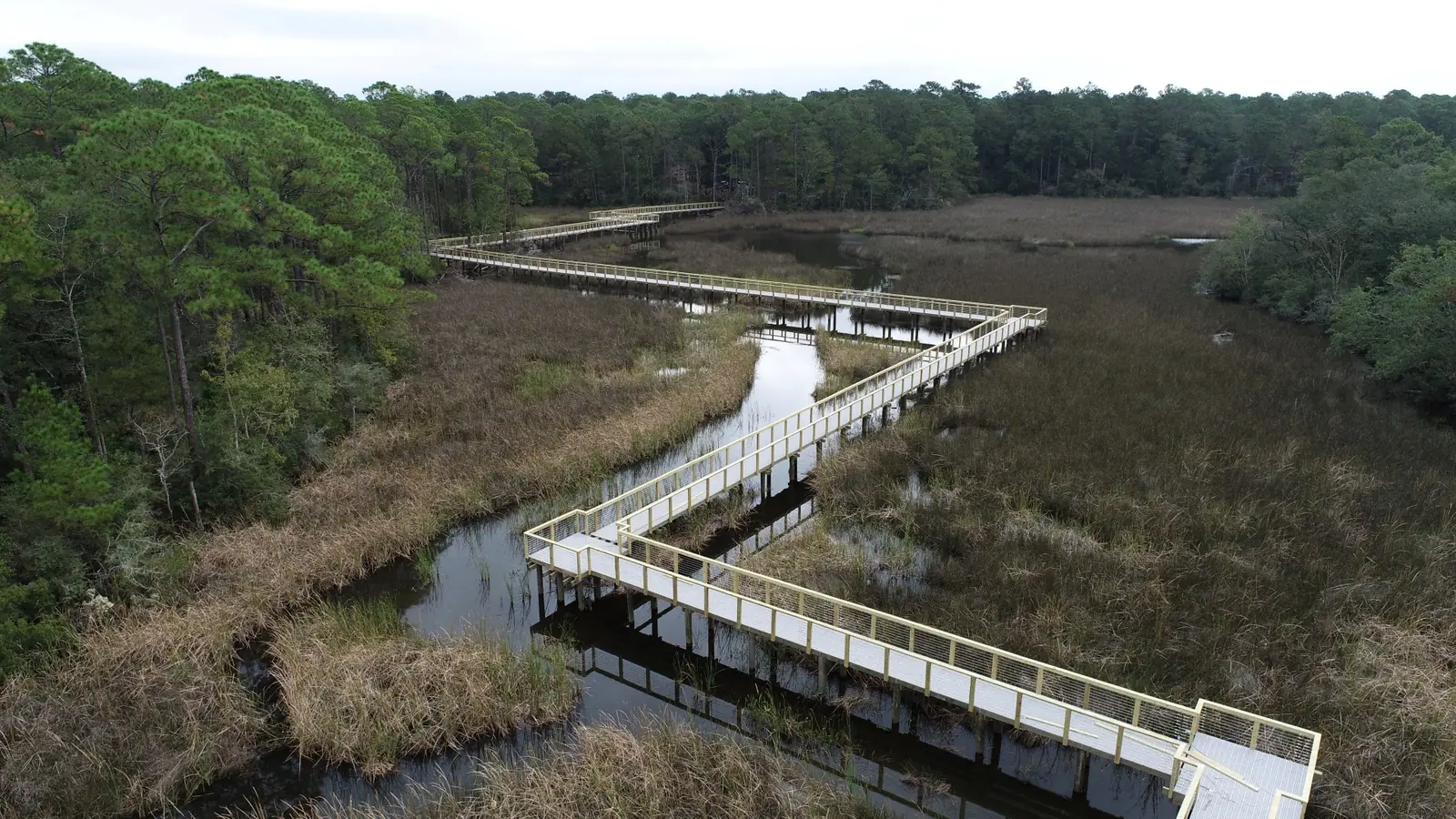
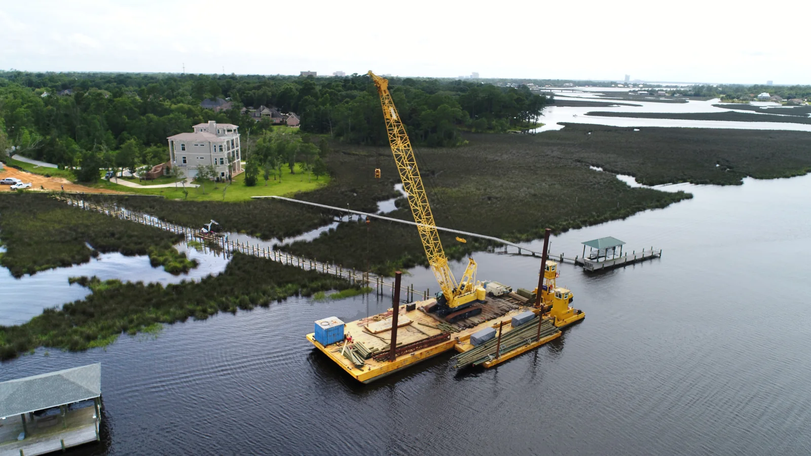
- Piers, docks and marshwalks: public park piers, fishing and kayak access, and private residential piers. Alignments and piling are set to avoid seagrass and limit marsh shading.
- Shoreline stabilization: bulkheads, revetments and living shorelines (oyster shell sills, breakwaters, marsh plantings), and hybrids of hard and natural sections.
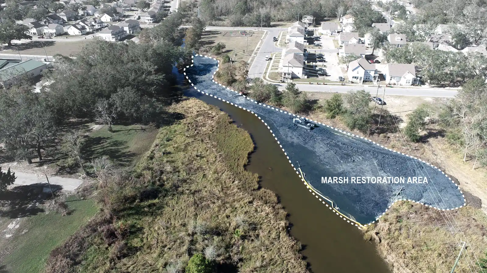
- Dredging and beneficial use: maintenance dredging of basins and channels, and placing dredged material to rebuild marsh.
- Marsh and tidal channel restoration: grading, tidal circulation channels and sediment placement.
- Waterfront sites: grading, drainage and stormwater for parks, ports and coastal parcels, including buildings and parking in FEMA V and AE zones.
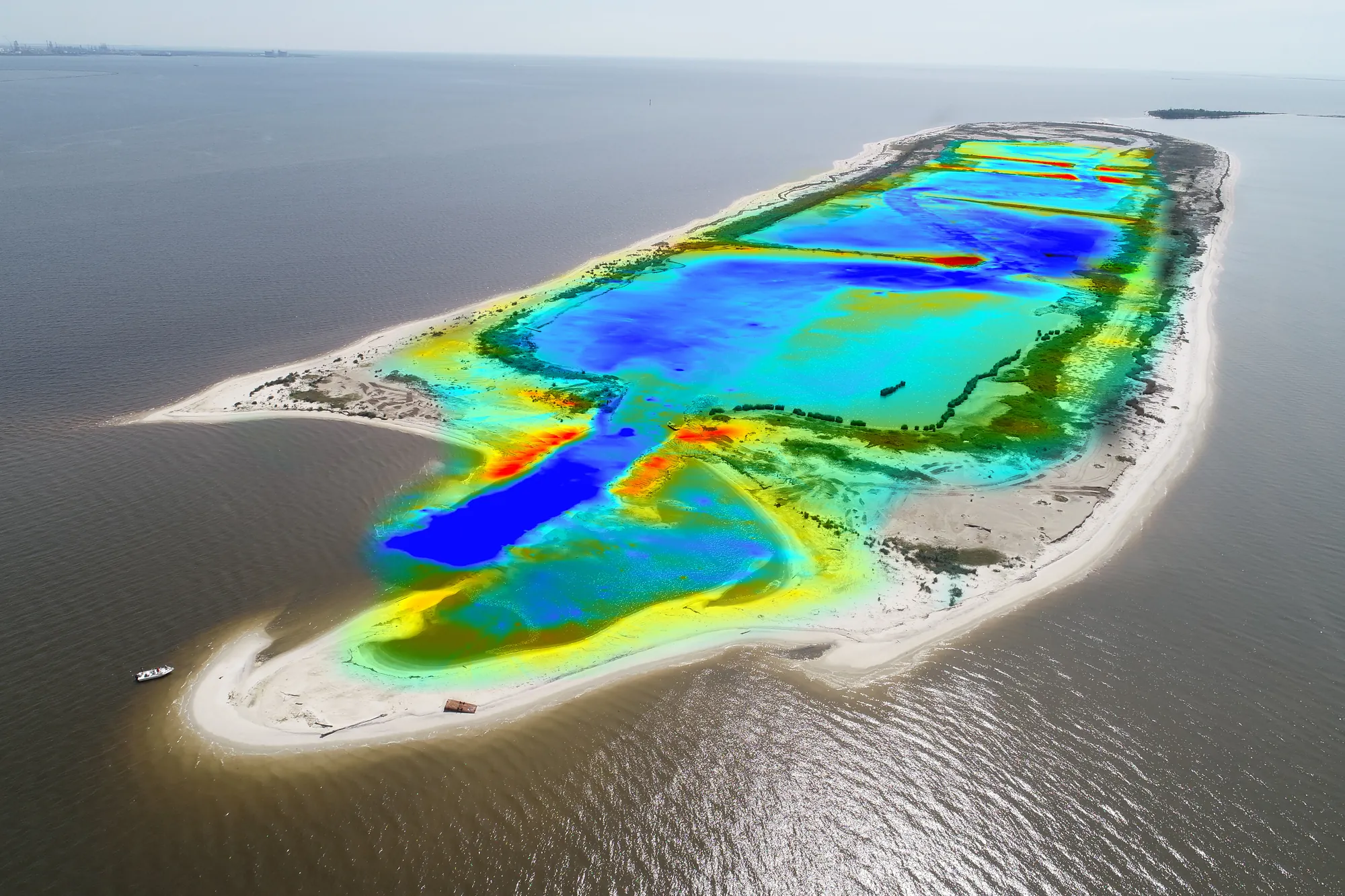
- Survey for design: topographic and bathymetric (hydrographic) survey, with drone mapping where it helps.
Read the background in What is coastal engineering? and hard vs. soft shoreline engineering.
Common failure modes
- Flanking and scour around a wall built without a toe
- Beach or marsh lost in front of a reflective structure
- Dredged material that won’t stay in place
- A living shoreline planted in the wrong wave-energy zone
The laws and programs that govern coastal work
- Section 10 of the Rivers and Harbors Act (33 U.S.C. 403): any structure or work in navigable waters, such as piers, pilings, bulkheads or dredging, needs Corps of Engineers authorization, and often Coast Guard signoff.
- Section 404 of the Clean Water Act (33 U.S.C. 1344): placing fill or dredged material in waters of the U.S., including wetlands. See what a 404 permit is.
- Section 401 water quality certification: the state certifies the federal permit. 401 vs. 404.
- Coastal Zone Management Act consistency: the state coastal program must concur that the project is consistent with its enforceable policies. If the state neither concurs nor objects within six months of receiving the certification, concurrence is presumed (33 CFR 325.2(b)(2)(ii); 15 CFR 930.63). See CZM consistency in MS, AL and FL.
- State coastal programs: Mississippi Department of Marine Resources (Coastal Wetlands Protection Act, Hancock, Harrison and Jackson Counties); ADEM coastal permitting in Alabama's Baldwin and Mobile Counties; Florida Environmental Resource Permit (Chapter 62-330, F.A.C.), plus sovereign submerged lands authorization and Coastal Construction Control Line rules on the Gulf front; Louisiana coastal use permit from the Office of Coastal Management. State water quality and coastal permits.
- FEMA flood zones: V and VE zones are coastal high hazard areas (wave heights of 3 ft or more). There, new buildings must sit on piles or columns with the lowest horizontal structural member at or above base flood elevation, cannot use fill for structural support, and must keep the space below free of obstruction or enclosed with breakaway walls (44 CFR 60.3(e)). Coastal AE zones landward of the LiMWA see 1.5 to 3 ft waves. FEMA map decoder: V zones and the LiMWA.
- Section 408: work that touches a federal project, such as a navigation channel or levee, needs separate Corps permission. What is Section 408?
Who reviews what, by state
| State | Corps district (regulatory) | State coastal and water quality lane |
|---|---|---|
| Mississippi (coast) | Mobile District | MDMR coastal wetlands permit and consistency; MDEQ 401. Joint application with the Corps. |
| Alabama | Mobile District | ADEM coastal permitting and consistency (ACAMP); ADEM 401. |
| Florida | Jacksonville District (all of Florida) | FDEP or water management district ERP, which also serves as 401 and CZM consistency; state lands authorization; CCCL on the Gulf front. |
| Louisiana | New Orleans District | OCM coastal use permit; LDEQ 401. |
Which permit path fits
Planning-level guide based on the 2026 nationwide permits (effective March 15, 2026, expiring March 15, 2031). The Corps district makes the final call, and regional conditions apply.
| Project | Usual federal path | Limits and triggers to check |
|---|---|---|
| Bank stabilization (bulkhead, revetment) | NWP 13 | 500 ft along the bank unless waived (bulkhead waivers capped at 1,000 ft). PCN if over 500 ft, over 1 cubic yard per running foot, or in special aquatic sites. |
| Living shoreline (sill, breakwater, marsh fill) | NWP 54 | 500 ft along the bank and 30 ft channelward of mean low water, unless waived. PCN required for all new activities. |
| Minor dredging | NWP 19 | No more than 25 cubic yards. Not in seagrass, wetlands or coral, and no canal connections. |
| Maintenance dredging of an existing basin or channel | NWP 35 | Only to previously authorized or controlling depth, whichever is less. Upland disposal with sediment controls. |
| Private pier or dock | Regional or programmatic general permit, often run through the state agency | Seagrass, length, deck height and navigation. See our dock and pier permitting guide. |
| New dredging, marinas, large fills, or anything over the limits | Individual permit (standard permit) | Public notice, 401, CZM consistency, ESA and historic review. Plan in months to years. |
More on nationwide permits and dock and pier permitting on the Gulf Coast.
How long permits take
Each step has a set timeline in the regulations. Actual schedules run longer, because each step only starts once the agency has what it needs.
- Nationwide permits: if a PCN is required, the applicant may proceed if the district does not respond within 45 days of receiving a complete PCN (33 CFR 330.1(e)(1)). A finding that the PCN is incomplete restarts the 45 days. In our experience, plan on about 120-180 days from submittal to verification.
- Individual permits: USACE permitters we work with cite about 120 days for a standard individual permit review. In our experience, plan on 12 months at minimum, about 18 months typical, and 24 months for large, complex or controversial projects. The regulations set a 15-day target to issue the public notice once the application is complete, a 15- to 30-day comment period, and a 60-day decision target (33 CFR 325.2(d)).
- Why the clock pauses: the 60-day decision clock stops when the district asks for more information, and starts again from the same point once the answer arrives (33 CFR 325.2(d)(3)). Applicants get up to 30 days to respond (33 CFR 325.2(d)(5)). State certifications, CZM consistency, ESA consultation and historic review run on their own schedules. Those steps protect the resources the permit is meant to protect. The fastest way through is a complete, consistent application the first time.
- Design changes during review: in our experience, each change typically adds about six months, even small ones like three more parking spaces or a building 100 sq ft bigger. Revised drawings mean revised impacts, and agencies re-review them. We have seen five changes on one project, and one project take 13 years from start to permit.
Worked example (illustrative)
Illustrative only. Not a Cypress project; the numbers use the planning figures above.
A city wants a public fishing pier, a 400 ft living shoreline and a small parking area on a bayou in a coastal AE zone.
- Permit path: the shoreline is under the NWP 54 limits (500 ft), so it could go nationwide. The pier and parking push the project to an individual permit.
- Agency figure: USACE permitters we work with cite about 120 days for an individual permit review, and the regulations set a 60-day decision target once the public notice is out (33 CFR 325.2(d)). Real schedules run longer because each step waits on a complete record.
- Schedule if the design is final at submittal: about 18 months (typical individual permit, our experience).
- Schedule with one design change during review, such as moving the parking: 18 + 6 = about 24 months.
- Schedule with two changes: 18 + 6 + 6 = about 30 months.
- Decision-clock arithmetic: if the district asks for information on day 40 of its 60-day clock and the city answers in 30 days, the clock resumes at day 40. The decision target moves from day 60 to about day 90.
The six-month difference per change is why we settle the layout, the seagrass and wetland limits and the flood-zone design before the application goes in.
What we would do on your project
- Check first: we would not draw a layout before confirming the wetland and seagrass limits, the flood zone, any federal project nearby (Section 408), and who owns the water bottom.
- Survey the site: topography, bathymetry and the wetland line.
- Set the permit path with the agencies: nationwide, general or individual permit. Hold a pre-application meeting when it is an individual permit.
- Design to the permit: alignment, piling, elevations and shoreline type chosen to fit the permit limits and the FEMA zone.
- Submit one complete application, with drawings that match the impacts tables.
- Answer agency questions quickly, and hold the design steady while it is under review.
- Bid support and CE&I: inspect construction against the drawings and permit conditions, and close out the permit.
See construction engineering and inspection and civil engineering design.
Projects
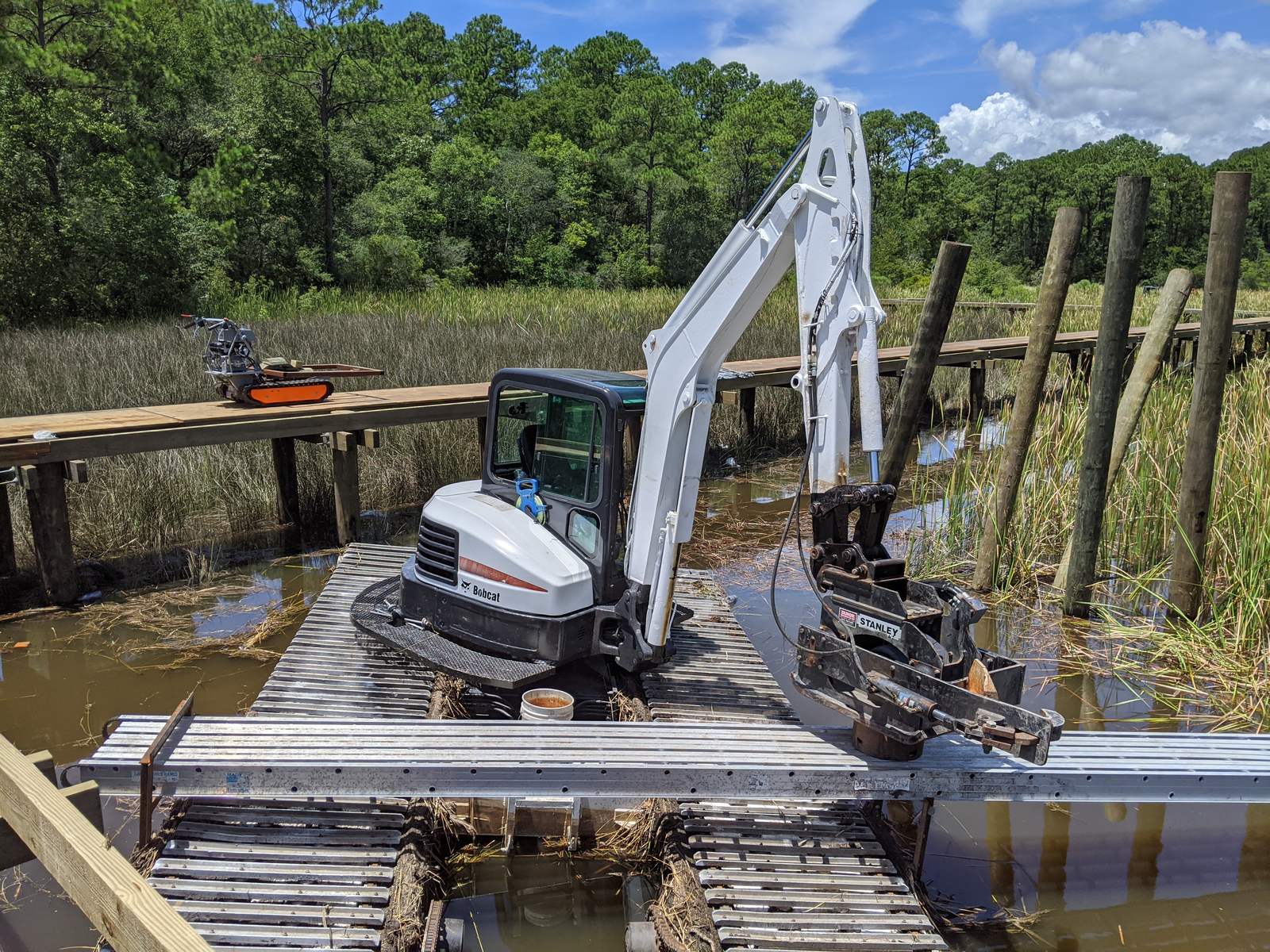
- Shepard State Park marshwalk (City of Gautier): design, permitting and CE&I for a sightseeing / walking path pier across tidal marsh and bayou. ASCE Mississippi Small Project of the Year and ENR Regional Best Projects, 2021.
- Round Island (MDEQ): topographic and bathymetric survey and CE&I for marsh restoration and intertidal circulation channels built with dredged material.
- Deer Island (Mississippi): multiple rounds of environmental monitoring for a beneficial-use marsh restoration.
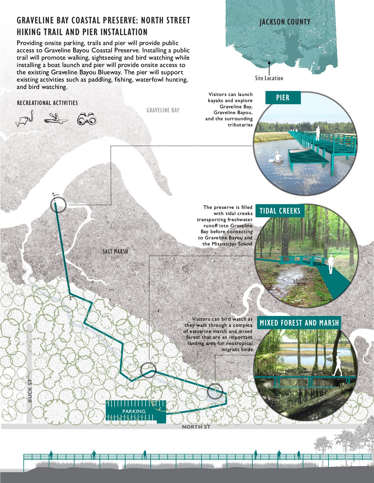
- Mississippi Coastal Preserves (MDMR): master-plan concepts for trails, piers, kayak launches and marsh restoration.
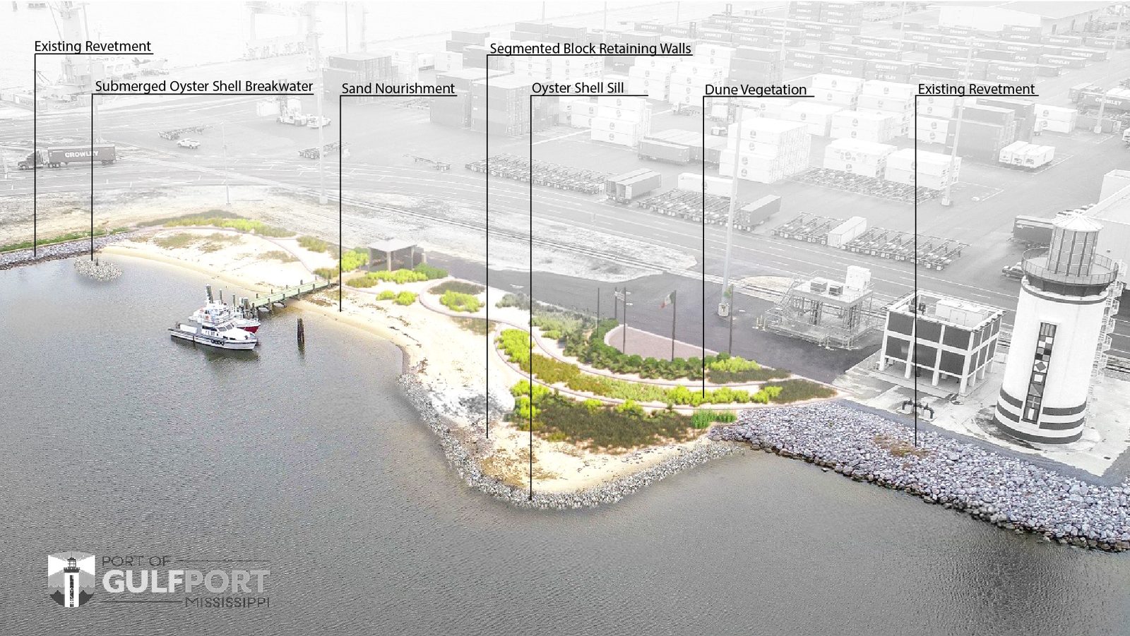
- East Pier and West Pier, Port of Gulfport (Mississippi State Port Authority): roadway, green infrastructure and stormwater park design; living shoreline and harbor boardwalk concepts.
- Bayou Auguste floodplain restoration (Land Trust for the Mississippi Coastal Plain): design, permitting and CE&I for tidal stream and marsh restoration.
- Residential piers: dozens of private piers, designed and permitted. See dock and pier permitting.
Limits and status
- As of October 12, 2026: the nationwide permits cited are the 2026 set (91 FR 768), effective March 15, 2026 through March 15, 2031. Corps districts add regional conditions.
- As of October 19, 2026: Florida's state 404 assumption was vacated, the D.C. Circuit affirmed on March 27, 2026, and it denied rehearing on October 7, 2026. The Corps (Jacksonville District) handles 404 in Florida.
- Timelines marked "our experience" are planning figures from our projects, not agency commitments.
- This page is general information, not a permit determination. The Corps and the state agencies decide jurisdiction and permit type.
- We design and permit. We do not perform construction.
Talk to a coastal engineer
Call 228-596-1580 or contact us. Offices: 772 Howard Ave, Biloxi, MS (headquarters); 150 Government St, Suite 950-1000, Mobile, AL; 13 Palafox Place, Pensacola, FL. Office locations. Licensed in MS, AL, FL, LA and GA.
Related: environmental consulting, wetland delineation, living shorelines, all services, projects.